STARSHIP'S CIRCUMNAVIGATION
February 1990 - December 1993
With my wife Vicky, and our children Sarah and Christopher we circumnavigated in Starship, our 44' home built, lift keel, aluminium cruising cutter . We departed from Coasters Retreat in Pittwater (near Sydney) in February 1990 and sailed across the top of Australia to Darwin, finally leaving there in early July, bound for the Mediterranean via the Red Sea and Suez. Concerned about the Gulf war and its possible impact on our security and the Suez Canal, we changed our plans at Cocos Keeling and after visiting the Chagos group, headed SW to Mayotte, and thence into the Atlantic via the Cape of Good Hope, finally reaching Ireland in June 1991 and cruising via Scotland as far North as Oslo. We spent part of that winter in Holland and then in February '92 crossed to England, staying over a month in Ipswich and another in London before moving around to the Solent, and then through France via Paris and various rivers and canals, finally reaching the Mediterranean in July 92 - more than a year later than originally planned, and at its western rather than eastern end.
Vicky taught both children using the Queensland Distance Education system for over 5 years (not actually corresponding with the school) , but our overall plan was still to be back home in time for Sarah to start high school in 1994. So rather than cruise east to Greece we reluctantly decided after visiting the Balerics and Spain to press on westward, crossing the Atlantic at the end of '92, through Panama in April 93, and back on our mooring in time for Christmas, with 38,000 miles under the keel. It was a great adventure, achieved a goal we'd set ourselves nearly 20 years earlier, and no doubt had a profound influence on our children, who arrived home aged 12 and 10 having visited 38 countries.
While a year or so longer than the minimum cruising-rally routes, ours was still a much quicker circumnavigation than many cruisers make. However we had cruised some of the Pacific on previous yachts, and we'd already lived on and cruised Starship for a year before setting off. We know another family who subsequently circumnavigated with children in their high school years using Australian correspondence schooling with excellent results, so another year in Europe probably wouldn't have mattered much overall, and would have allowed us to cruise the eastern Mediterranean. On the other hand we definitely don't regret the detour around Africa, as Mayotte, Mozambique, South Africa, St Helena, Ascension, the Cape Verdes, and the Azores are all fascinating places we would otherwise not have visited. Our children rate the game parks at the top of their experiences.
Route Comments
One aspect I feel worth mentioning was the clockwise route and timing of our cruise through Scotland and across to Scandinavia in late summer, and then back to the UK in mid winter. This gave us prevailing tail winds up the Irish Sea, in the long lakes of the Caledonian Canal, and across the North Sea, and meant we were transiting France in early summer before holiday traffic and water shortages effected the canals.
Had we entered the Mediterranean as originally planned from Suez, we would have in company with many other cruisers, been sailing across Biscay or Northwest through France in late summer or early winter (against the flow in the Rhone and Saonne), probably have wintered in the UK and pushed Northwards into Scandanavia the following summer, and then across the North Sea to Scotland, Ireland, relatively late in the season, against the prevailing SW winds and crossing Biscay to reach the Canaries by November for the transatlantic passage. As things turned out the route we followed made better use of the prevailing winds. The short winter crossing from Holland to the UK took advantage of stable (but cold) conditions associated with a large High pressure system.
Another comment is we found the South Atlantic to be pleasant sailing, as was beating against the trades in the North Atlantic in May, when they were quite light.
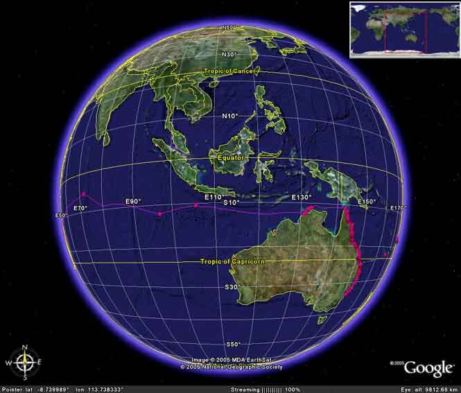
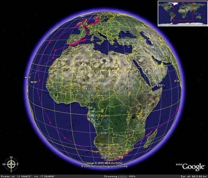
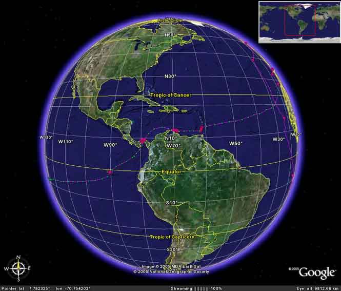
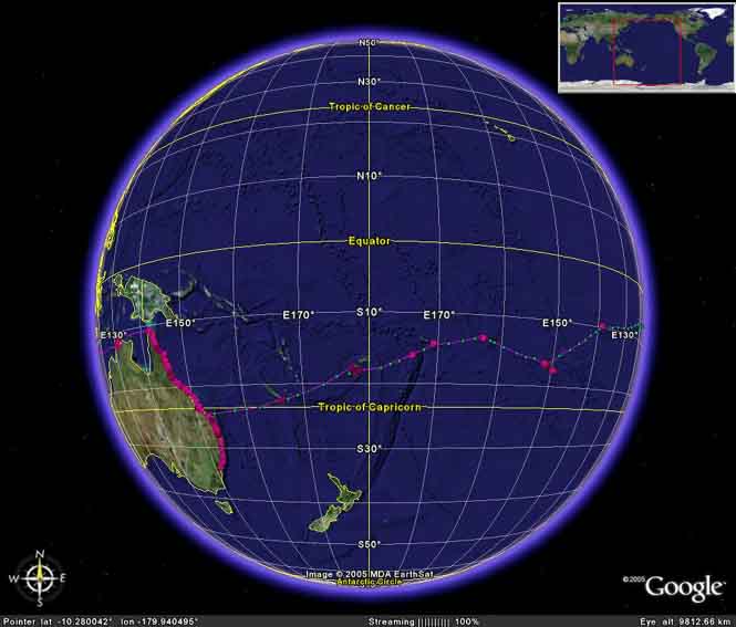
Below are four low resolution Google Earth screen shots of our route. A 125 kB "zoomable" .kmz file defining the route and providing dates and place names can be download here. (right click and select "Save As..") To open a .kmz file you will need to have installed Google Earth on your computer, which is available free from Google Earth - Home , and then to be connected to the Internet to access Google Earth's database of satellite images of the world. The route was reconstructed using Google Earth Plus, from our log and diary notes, and is certainly not a precise navigational record, especially since we used a sextant for navigating across most of the Indian and Atlantic Oceans, acquiring our first GPS receiver in the Caribbean.